


Backroad Mapbooks
$25.95 – $29.95
The Backroad Mapbook Series is the best selling Outdoor Recreation series in the country for good reason. They pride themselves on providing up-to-date information with all the details needed to get you to outdoors safely and confidently.
Here are a few features that make their maps and the accompanying writing both unique and user friendly:
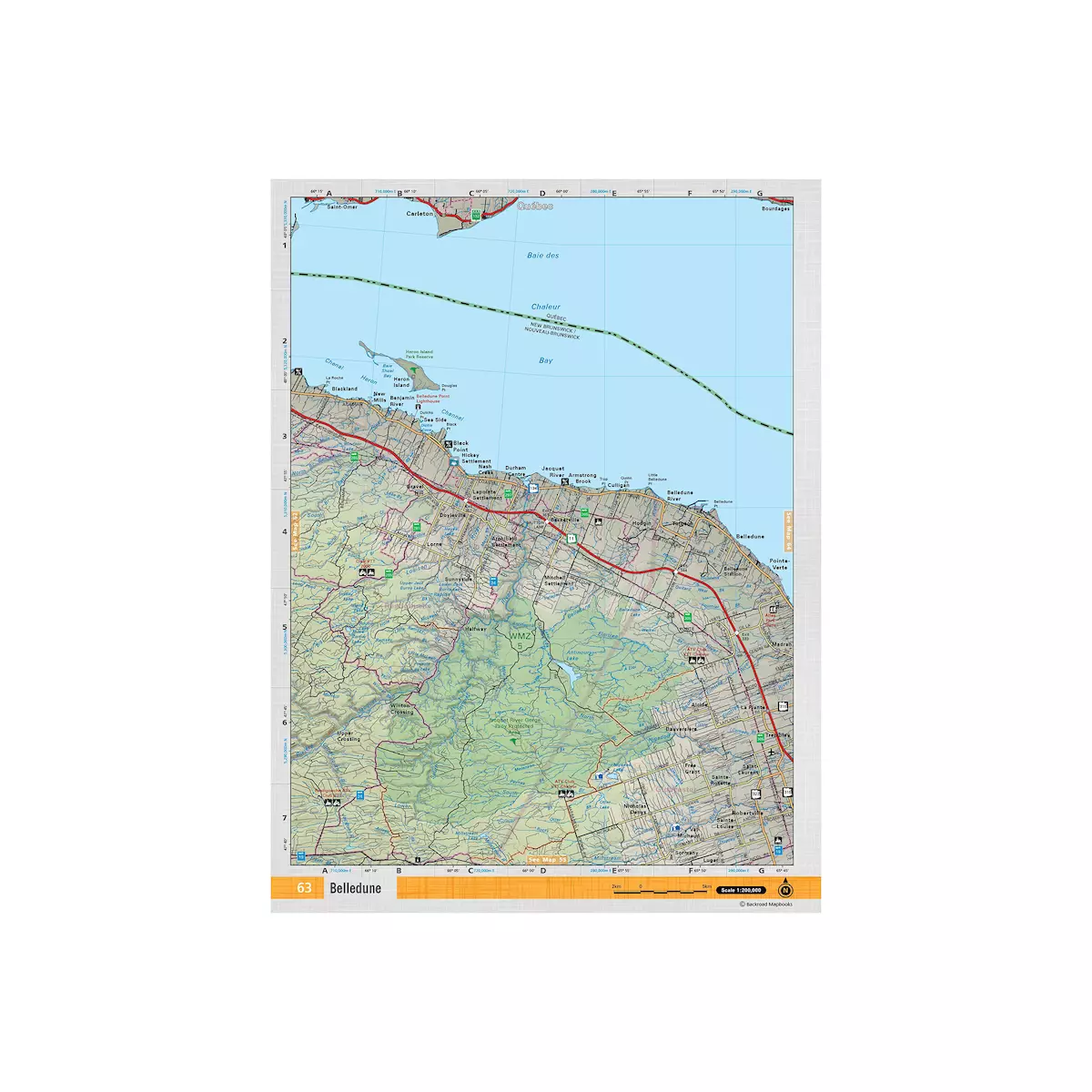
 ROAD FEATURES
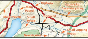 ROAD FEATURES
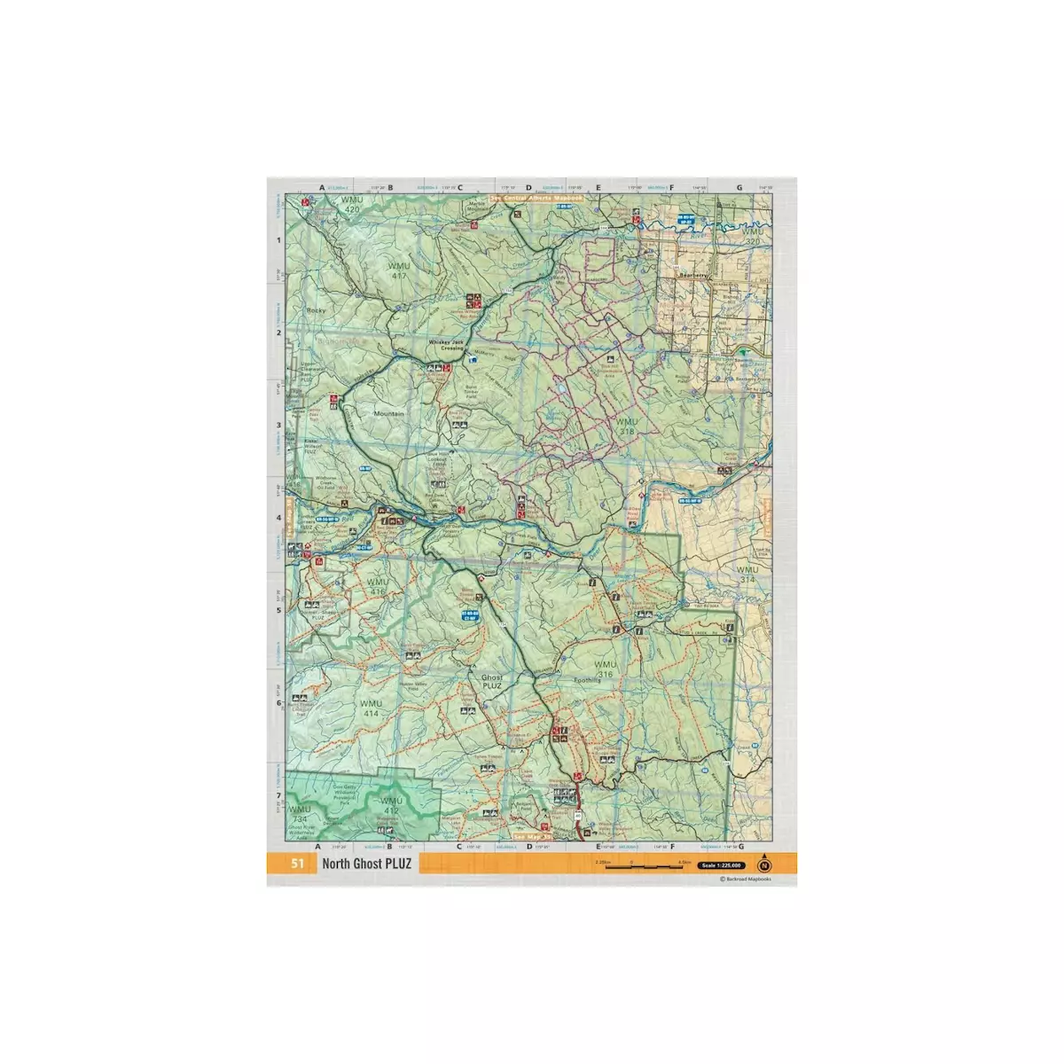
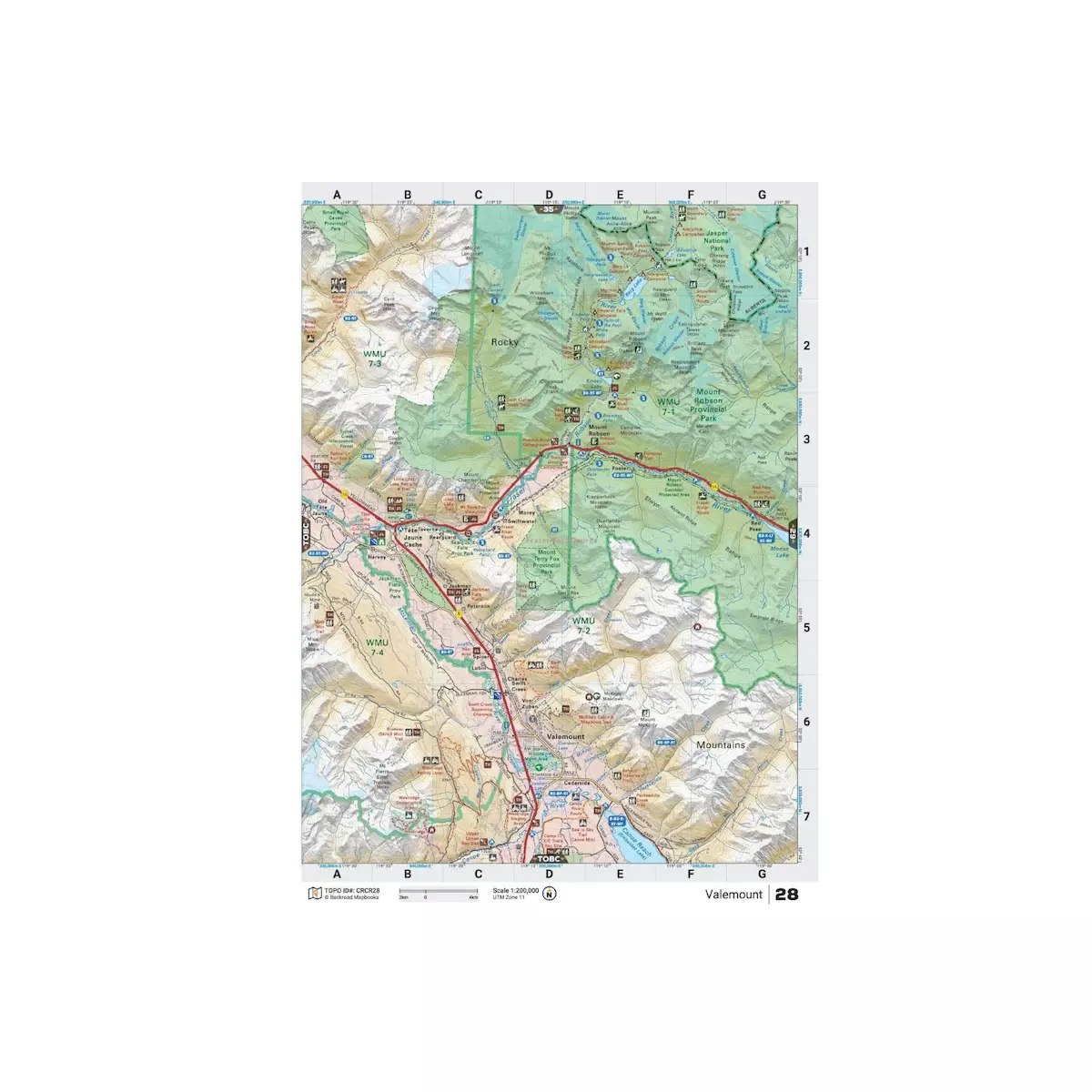
By combining city and rural roads with current forestry and logging road maps, these maps are designed for people wishing to get outdoors. A unique aspect of our maps is the fact it shows the many side roads and backcountry routes that other maps do not. Whether you are looking for a park to visit close to home or are more interested in finding that seldom-visited lake to fish Backroad Mapbooks leaves no place uncovered.
 TRAIL SYSTEMS
 TRAIL SYSTEMS
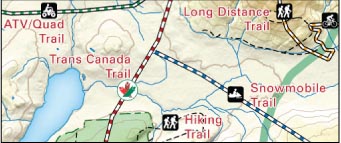
The maps highlight a wide variety of trail systems that range from popular hikes to a host of off-road routes. To aid users they have marked the trails with symbols designating which type of user can access the trail wherever space allows. Another helpful feature is the fact that ATV, snowmobile trails and long distance trails are highlighted with a background colour to allow for easier navigation along this linear routes.
 PADDLING ROUTES
 PADDLING ROUTES
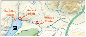
One of the most unique aspects of these maps is the fact that they show the various paddling opportunities in the area. Whether you are a canoeist looking to paddle a peaceful lake route, or a kayaker seeking the thrills and chills of whitewater, these maps and writing are sure not to disappoint. In addition to marking access points, it notes portages as well as the water route itself.
 PARKS & RECREATION AREAS
 PARKS & RECREATION AREAS
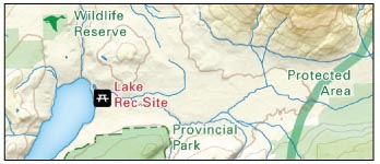
Ok sure, most maps mark the provincial and national parks. But few mark those backcountry campsites that make Canada such a wonderful place to explore? On top of these, it also notes natural areas, conservation areas and wilderness areas that few other map sources do.
 OTHER RECREATIONAL FEATURES
 OTHER RECREATIONAL FEATURES
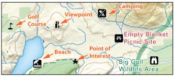
In addition to clearly marked trails and parks, you will also find a wide range of other recreational opportunities marked. These range from beaches to wildlife viewing opportunities. These features are labeled in green (for parks) or red (for recreation) and are usually accompanied by the appropriate recreational symbols.
 WILDLIFE MANAGEMENT UNITS
 WILDLIFE MANAGEMENT UNITS
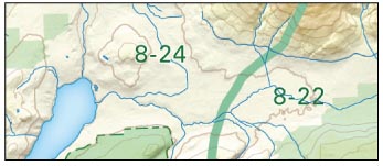
Hunters and anglers will also be happy to see that they have included the Management Units on the maps. The big green number notes the zones, while the boundaries are marked with a faint green border.
ELEVATION RELIEF SHADING
 ELEVATION RELIEF SHADING
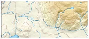
The newest maps have taken the concept of relief shading to a whole new level. On top of showing soft shadows and highlights to accentuate the changes in the slope of the terrain (as if you were viewing the area from above), but they also changed the colour to match the elevation. For the casual user, this adds a nice colouring that helps the readability of the maps. For the more experienced user, you can really study the subtlety of the land. In case you were wondering, the relief shading was done as if the sunlight originates from the northwest (upper left section of the map).
 CONTOUR LINES & LABELING
 CONTOUR LINES & LABELING
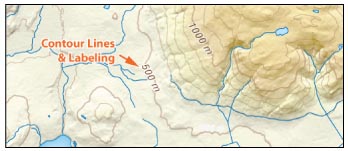
The addition of contour lines have taken the maps from simple travel guides to full blown topographical maps. When the contour lines are combined with the relief shading, it is very easy to see the changes in the slope of terrain, particularly in the mountains or prominent river valleys of the prairies. For the ‘mountainous’ titles from the Rockies west, the contour intervals are 100 meters. Eastern users will find the contour intervals are only 30 meters.
GPS COMPATIBLE WITH UTM GRIDS
 GPS COMPATIBLE WITH UTM GRIDS
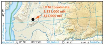
A useful navigational feature on the maps is the small numbers provided around the map borders. These blue numbers represent UTM Grids and the black numbers represent Longitude and Latitude reference points. Although most GPS units are set to longitude and latitude, switching the unit to UTM (NAD 83) is both easier and more accurate for land-based travel. Since the maps provide UTM grid lines that are 10,000 metres (10 kilometres) apart (both east & north), users can accurately pinpoint the location of features by dividing the grid into 10 equal parts (both east & north). Counting the number of tics from the nearest coordinate value and multiplying by 1,000 will give you the UTM coordinate. Do this for both the Easting and the Northing and you will have an accurate GPS waypoint.
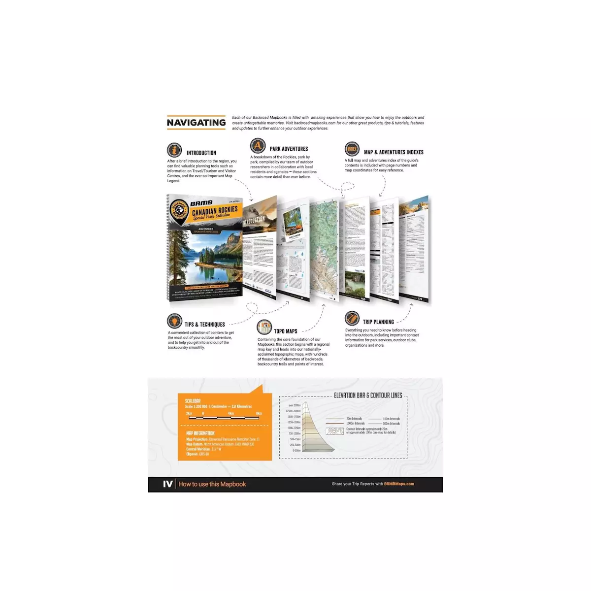
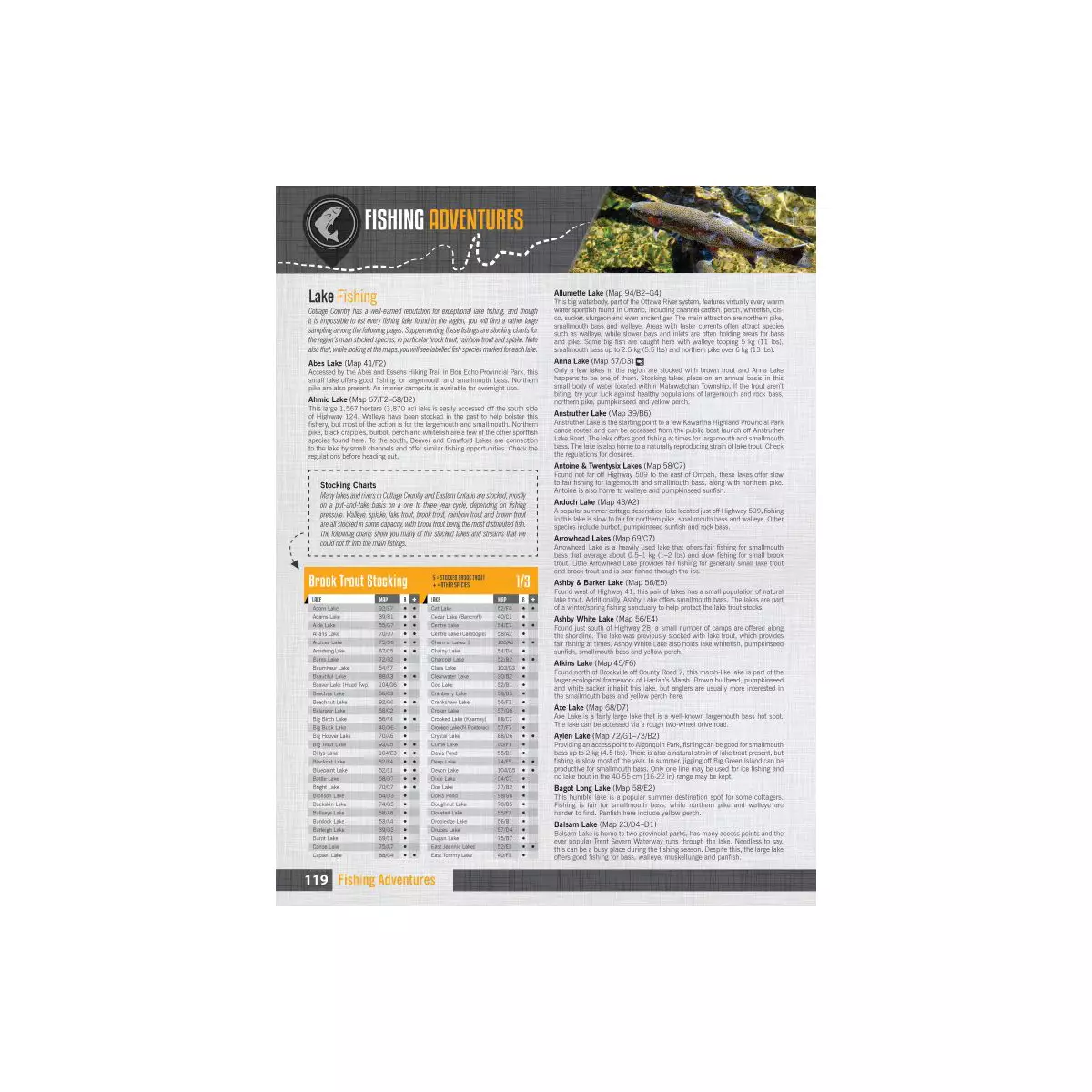
 THE WRITING
 THE WRITING
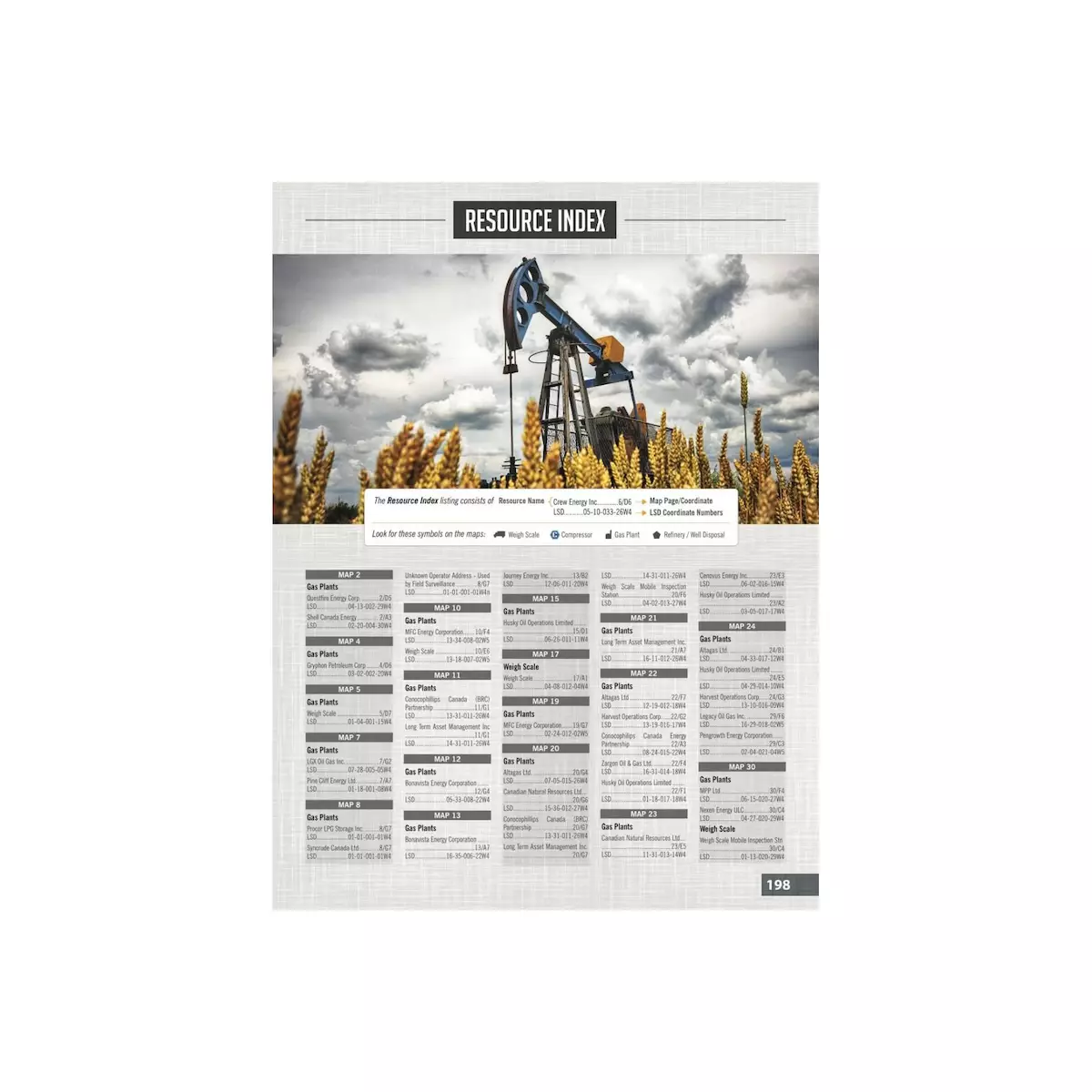
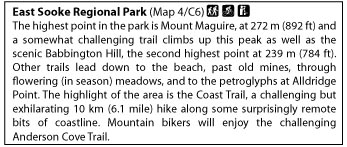
In addition to the detailed maps, Backroad Mapbooks spend countless hours researching and writing about the various recreational opportunities in each area. Fishing, paddling, hiking, camping, wildlife viewing, snowmobiling, ATVing, skiing, biking, touring…you name it, they cover it. In addition to being grouped by alphabetically by category, each listing is given a map coordinate so you can easily locate it. With thousands of listings in each book, it can be safely said that every book lists more recreational opportunities than you can possibly do in a lifetime.
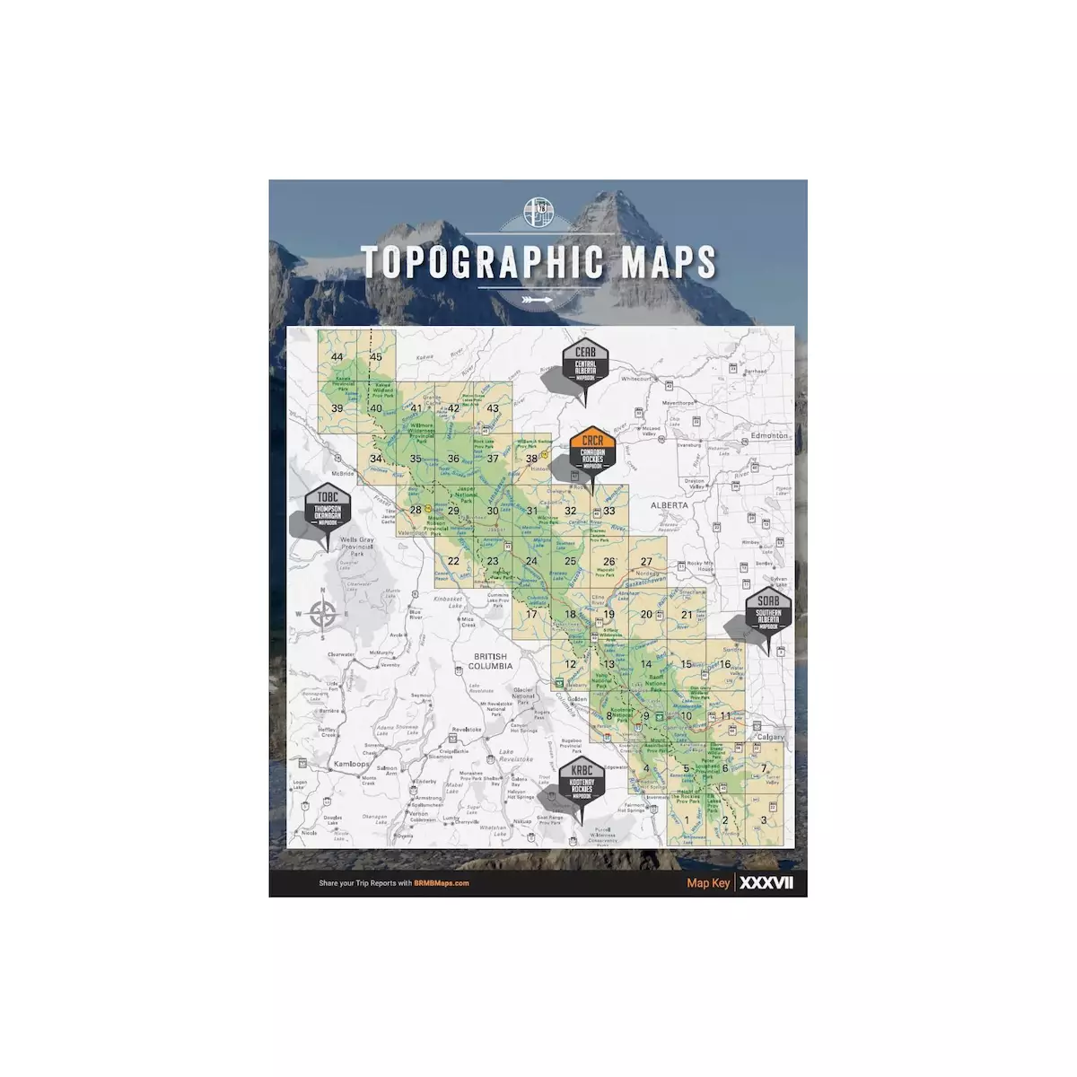
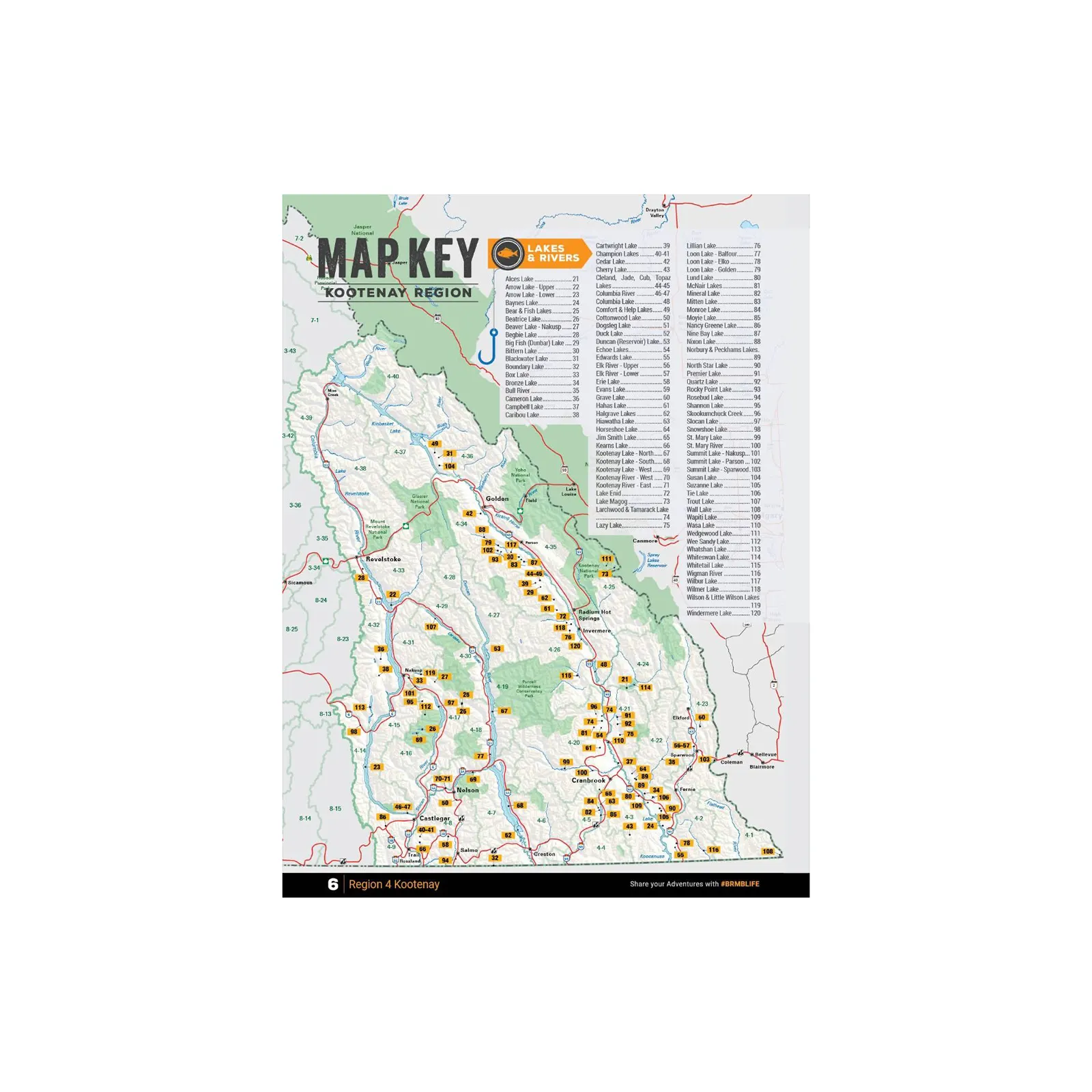
 INDEX & MAP KEY
 INDEX & MAP KEY
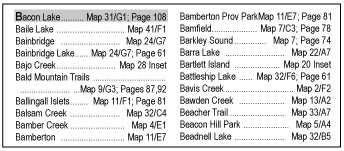
No mapbook would be complete without an index and map key. Backroads Mapbooks provide the index at the back to help you find a specific area or site and the appropriate reference page or map coordinate. The map key is found at the back of the book and at the start of the maps and is designed to help you find a general area you want to explore. Individual write-ups on fishing, paddling routes, parks, trails, etc. can be found through the index or by searching the appropriate reference section.
| Weight | N/A |
|---|---|
| Dimensions | N/A |
| Regions | Northern Alberta, Central Alberta, Southern Alberta, Canadian Rockies, Northern BC, The Kootenay Rockies BC, Thompson Okanagan BC, Vancouver, Coast & Mountains BC, Vancouver Island BC – Victoria & Gulf Islands, Cariboo Chilcotin Coast BC, Saskatchewan, Manitoba, Northeastern Ontario, Southern Ontario, Cottage Country Ontario, New Brunswick & PEI, Fishing Kootenay Region BC, Fishing Central Ontario, Fishing Eastern Ontario, Waterproof Map – Algonuin Provincial Park, Ontario |
| Brand | Backroad Mapbooks |